Introduction
Welcome to Boston, a city with history and modern energy, steeped in charm yet brimming with movement. In this article we’ll dive into Boston driving and transit so you can travel confidently whether you’re a first-time visitor, a new resident, or a frequent traveler. We’ll cover major roads and highways, highlight transit routes, explore key neighborhoods, and deliver practical routing advice to avoid traffic traps and make the most of the city’s layout.
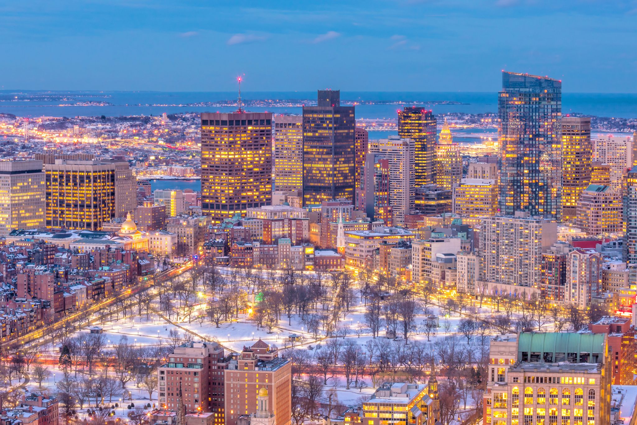
Understanding Boston’s Layout
Boston is structured around a dense downtown core—then radiating outward to historic neighborhoods and suburban corridors. Two major highways, Interstate 90 (the Massachusetts Turnpike) and Interstate 93, define much of the vehicular access. Wikipedia
Public transit operated by the Massachusetts Bay Transportation Authority (MBTA) forms the backbone of non-car travel, including subway, commuter rail, bus and ferry services. Boston.gov+1
Neighborhoods like Downtown, Back Bay, North End, South Boston, and Cambridge each have distinct identities—knowing them helps in planning routes and transit use.
Key Highways and Road Routes
When driving in Boston, familiarity with the major corridors gives you an edge.
The Massachusetts Turnpike (I-90)
This highway enters from the west, travels through Boston, and provides one of the main east-west routes. It connects to major hubs and suburbs. Wikipedia+1
Useful tip: If you’re arriving by car from the western suburbs or further, using I-90 early in the day gives you relatively smooth access to downtown.
Interstate 93 & radial corridors
I-93 runs north-south through Boston and links to the suburbs. It is one of the primary exit/entry points for the central area. Wikipedia+1
For example, arriving from the north or south, you’ll likely use I-93 and then transition onto inner city roads.
Other major roads and corridors
Routes like US 1, Route 128 (the job-belt highway around Boston), and radial corridors support traffic flow out of downtown. bostonmpo.org+1
Inside the city you’ll encounter streets such as Huntington Avenue in Back Bay and Fenway, which serve both transit and driving. Wikipedia
Transit Options: Subway, Bus, Bike & More
Relying purely on a car in Boston can be restrictive; transit often offers a smarter alternative.
The Subway (“The T”)
The MBTA subway lines are color-coded: Red, Orange, Green, Blue. They serve major neighborhoods and link to commuter rail. Compass Furnished Apartments+1
For visitors or residents, getting a rechargeable transit pass or card boosts convenience.
Heads-up: The subway system’s central stations connect to many of the city’s most visited districts.
Buses, Commuter Rail, Ferries
Where the subway doesn’t reach, buses fill the gap. Commuter rail extends to outlying suburbs, and ferries serve waterfront locations and nearby towns. Compass Furnished Apartments+1
If you’re staying in a neighborhood with less subway access (for example parts of Roxbury or Dorchester), bus or commuter rail may be more efficient.
Walking and Cycling
Boston is relatively compact and walkable in many neighborhoods, and bike-share programs and dedicated lanes make cycling a viable option. Boston.gov+1
For short distances inside the core neighborhoods, walking often beats parking your car.
Neighborhood Snapshots & Route Planning
Let’s explore major neighborhoods, what to expect when traveling through them, and how to plan efficient routes.
Downtown & Back Bay
Downtown is the commercial heart; Back Bay features the famous Prudential Center, Newbury Street and luxury residential blocks.
If driving, expect dense traffic after typical business hours. Parking is expensive and limited. Using transit in this zone is often wiser.
North End & Waterfront
North End is historic, compact, and has narrow streets. The Waterfront offers scenic walking.
If you arrive by car, plan to park in a public garage and then walk or take the T. The keyphrase Boston driving and transit is especially relevant when choosing whether to switch from driving to transit.
Fenway, Mission Hill & Brookline
These neighborhoods straddle transit lines (Green Line) and are accessible by both car and transit. If you drive, be aware of university-related traffic and parking restrictions in the evenings.
South Boston & Seaport
The Seaport district is rapidly developing and draws a lot of visitors. Roads can get congested, so using transit may save time.
Cambridge & MIT/Harvard area
Across the Charles River, Cambridge is well connected by the Red Line and buses. Driving from downtown Boston into Cambridge often involves crossing busy bridges and dealing with rush-hour constraints. Switching to transit is wise here.
Practical Driving Tips & Traffic-Avoidance Strategies
Driving in Boston requires planning. Here are actionable tips you can use right away.
- Avoid peak commuter hours. Typically 7:30-9:30 a.m. and 4:30-6:30 p.m. are the worst for major roads.
- Use the latest traffic-apps to monitor delays on I-90 and I-93; congestion is a persistent issue.
- Consider parking outside the central core and take transit in; this hybrid strategy fits the theme of Boston driving and transit.
- Know the major entry roads and bridges: for example, the Zakim Bridge connects north-of-Charles neighborhoods to downtown.
- Plan parking ahead of time—many garages fill early in Back Bay and downtown during events.
- Be prepared for one-way streets and confusing street patterns in older neighborhoods (Boston was built before the grid system).
- If renting a car, choose a smaller vehicle; tight streets and parking meters favor compact cars.
- Use ride-share or taxis when you’ll end your driving at a parking-unfriendly location (waterfront, North End dinner, etc.).
- Be aware of residential parking zones—they are strictly enforced in many Boston neighborhoods.
- When heading to or from Logan International Airport, the Blue Line subway or Silver Line bus often beats driving, especially during traffic. Compass Furnished Apartments+1
Route Planning: From Point A to Point B
Let’s look at practical route examples and how to combine driving and transit smartly.
Example 1: Arriving at Logan Airport and Going to Cambridge
Rather than drive across the city, you can take the Blue Line from Airport Station to downtown and then the Red Line to Harvard Square. The keyphrase Boston driving and transit captures the idea of preferring transit in this case.
If you insist on driving, you’d use I-90 or local roads, cross the Longfellow Bridge and deal with Cambridge traffic.
Example 2: Driving from Western Suburbs into Fenway for a Game
Take I-90 east, exit toward Kenmore or the Fenway area. Then use a public garage and walk or take a short transit ride to your destination. That blend of car + transit is exactly part of the Boston driving and transit approach.
Example 3: Visiting the Seaport from Back Bay
Driving the short distance can get bogged down in Seaport traffic. Instead, park near Back Bay Station, take the Orange Line or a bus to South Station, then walk or ride a shuttle into the Seaport.
Here you are leveraging transit for the busy zone to reduce stress.
Understanding When to Use Transit vs Drive
Choosing between driving or taking transit depends on your destination, timing and purpose.
- For downtown to downtown travel, transit wins.
- For late-night airport runs, ride-share or taxi might be better than driving and parking.
- For living in a suburban area and commuting into Boston, driving until a transit park-and-ride and then taking commuter rail makes sense.
- For exploratory trips during your stay (tourist mode), walking + subway + short rides will often beat renting a car.
- For family groups with luggage or off-hour arrivals, a car may be more convenient, but parking cost and street complexity must factor in.
Highlighting Major Landmarks & How to Reach Them
When you’re exploring Boston, knowing how to reach key sites efficiently matters.
Boston Common & Public Garden
Located in downtown, right by major subway lines (Park Street, Boylston). Ideal to reach without a car.
Fenway Park
Driving gets tricky during baseball season; better to use the Green Line Kenmore stop.
Harvard Square
In Cambridge; take the Red Line and avoid bridge-traffic.
Seaport District
Transit or walk from South Station is often quicker than driving through congested streets.
Allston / Jamaica Plain
These neighborhoods sit at the terminals of major Green Line branches (B, C, D, E) so transit access is strong.
Avoiding Traffic Bottlenecks & Parking Challenges
Let’s engineer your route to circumvent common pain points.
- The “Big Dig” project restructured city highways but some choke points persist in I-93/I-90 interchange. Wikipedia+1
- The roads along the Charles River such as Storrow Drive fill quickly in rush-hours; if heading east/west along the riverfront, choose alternate hours or transit. Wikipedia
- Parking garages are expensive – consider transit to avoid full cost of downtown parking.
- During major events (sports, conventions) both roads and transit get crowded—book parking or tickets in advance.
- Residential zones enforce overnight permits—if staying in a rental or Airbnb, check parking rules ahead.
- Bridge closures/special lanes: keep an eye on local traffic alerts for alternate routes.
Practical Itinerary Example: One Day in Boston
Here’s how you can apply Boston driving and transit principles to a one-day outing.
- Arrive in the morning via subway or park in Back Bay garage.
- Walk from Back Bay to the Public Garden and Boston Common.
- Take the Green Line to Fenway for lunch and then catch a short bus or walk to the Seaport area.
- In the afternoon, hop on the Red Line to Harvard Square for Cambridge exploration.
- In the evening, if you drove, pick up your car and head out; if you parked and left it, take the subway back to your accommodation.
- If you’re leaving late, use a ride-share service to the airport rather than fighting parking.
Summary & Final Thoughts
Mastering Boston driving and transit means understanding when to drive, when to ride, and how to move between neighborhoods effortlessly. The city offers dense neighborhoods, historic streets, major highways and a robust transit network. By combining driving for access and transit for efficiency you’ll save time, reduce stress and enjoy the city more fully. Whether you’re exploring as a visitor, commuting as a resident or planning a move, this practical guide arms you with actionable insight.
Embrace the transit system, plan your routes smartly, and choose your parking carefully. You’ll find Boston far more navigable than many assume—and far more enjoyable to discover.
Explore the Services
Home | About Us | Pricing | Our Office | Get Started | FAQ | Dispatch Daily | Contact Us
WhatsApp | Facebook | LinkedIn


Leave a Reply