Introduction
Welcome to your comprehensive guide on New York City travel routes. Whether you’re a first-time visitor, a new resident, or someone planning to explore or navigate the city in depth, this post is crafted for you. You’ll gain practical insight into the major corridors, how the city is laid out, transport options, driving and traffic advice, plus key neighbourhoods and landmarks to anchor your journey. By the end, you’ll feel confident about moving through the city efficiently, avoiding common traffic traps, and getting the best from your time in New York.
Understanding the Layout of New York City
To use your New York City travel routes wisely, you need a foundational map in your mind of how the city is structured.
The Five Boroughs
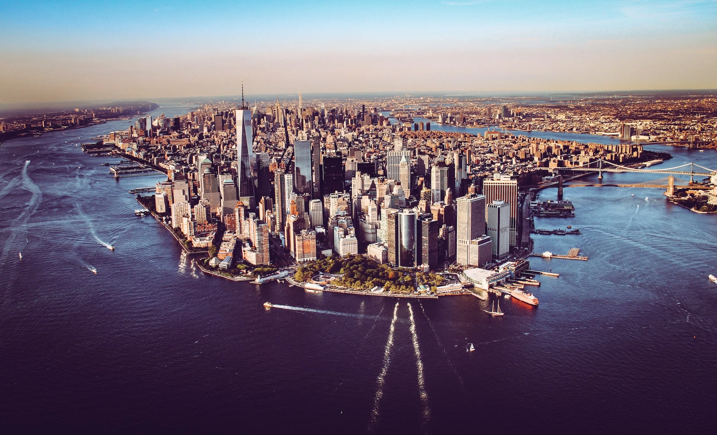
New York comprises five boroughs — Manhattan, Brooklyn, Queens, The Bronx, and Staten Island. Manhattan is the dense core where many travellers spend much of their time. Each borough has its own character and transport links.
Manhattan’s Grid and Major Thoroughfares
In Manhattan, the street grid (especially north of 14th Street) is a major navigational aid. Streets run east-west, avenues run north-south. Key avenues such as Fifth Avenue, Park Avenue, Broadway and Sixth Avenue serve as major travel routes. Meanwhile, crosstown streets like 34th Street, 42nd Street, and 125th Street are important for east-west travel.
Major Traffic Corridors Outside Manhattan
When you venture beyond Manhattan, major highways and bridges/tunnels come into play. For example:
- The New York State Thruway (I-87) and others connect upstate and suburbs.
- The Brooklyn‑Queens Expressway (BQE) loops around Brooklyn and Queens.
- East-west state routes on Long Island, such as New York State Route 25, extend travel options beyond the core city.
Understanding these patterns gives you the framework for mapping out your trips.
Key Travel Corridors and Routes to Know
When you refer to New York City travel routes, here are the essential corridors that bring the city together.
Central Manhattan to Midtown
If you’re staying or touring in Midtown (around Times Square, Rockefeller Centre, Bryant Park), the major north-south avenues and crosstown routes matter. For instance, 7th Avenue, Broadway, and Sixth Avenue run north-south, while 42nd Street and 57th Street are important east-west connectors.
Uptown to Downtown
Travelling from Uptown to Downtown means going roughly from 125th Street/Harlem down to the Financial District. Major north-south avenues like 5th Avenue or Broadway help. For east-west travel, think 42nd, 34th, or 14th Streets.
Brooklyn, Queens, and The Bronx Access
To get out of Manhattan into the outer boroughs or to plan connecting routes, consider:
- Bridges like the Brooklyn Bridge, the Manhattan Bridge, and the Queensboro Bridge.
- Tunnels such as the Holland Tunnel or the Lincoln Tunnel for connections to New Jersey.
- Expressways like the BQE (Brooklyn-Queens Expressway) or FDR Drive along Manhattan’s east side.
Waterfront and Ferry Options
For the east and west river edges, the city also offers ferry and waterfront routes. Planning via the waterfront can avoid heavy traffic. Plus, these routes often offer scenic value and might be faster during peak driving times.
Transportation Options: Which Mode to Choose?
To fulfil your goals with New York City travel routes, you’ll want to pick the right transport method for each leg of your journey.
Subway and Bus Network
The city’s public transit network is dense and effective. For example, the Metropolitan Transportation Authority (MTA) publishes subway maps and bus service guides to help travellers get around efficiently.
If you’re staying within Manhattan or connecting between boroughs via subway, this is often the fastest and most reliable option.
Driving & Ride-Sharing
Driving within Manhattan can be challenging due to heavy traffic, narrow streets, numerous signals, and limited parking. If you’re driving:
- Choose major avenues rather than small side streets.
- Avoid peak rush-hour windows (typically 7–9 am and 4–7 pm).
- Use expressways and tunnels for transit across boroughs rather than purely central city streets.
- Consider alternate routes along the waterfront (e.g., FDR Drive) to avoid main inland congestion.
Cycling and Walking
In many neighbourhoods, walking or cycling can be the faster, more enjoyable mode. The city has dedicated bike lanes and greenways, especially along the rivers — a great way to appreciate local life and avoid traffic snarls.
For short trips, walking also avoids all the transit transfer time and gives you flexibility.
Ferry and Waterfront Services
For connections, especially across the East River or via the Hudson, ferries provide a low-stress choice. These are often moderately priced and offer scenic value, and may avoid traffic completely.
Planning Smart Routes in the City
Using New York City travel routes wisely means planning so your day-to-day movement is efficient and enjoyable.
Segment Your Day by Zone
Divide your itinerary into zones — for example: Uptown (Harlem, Upper East/West), Midtown (34th–59th St), Downtown (Financial District & SoHo), and the outer boroughs (Brooklyn, Queens).
Keep your activities within one zone for the majority of the day to avoid excessive travel time.
Use Major Corridors and Transit Hubs
Select routes that use major transit hubs and corridors:
- For Midtown to Midtown transfers, subway lines that run along Broadway or 6th Avenue are ideal.
- For cross-town trips, use 34th Street or 14th Street where available.
- For borough transfers, use bridge/tunnel links or expressways rather than meandering local streets.
Avoid Known Traffic Hotspots
Here are typical trouble spots:
- Crosstown routes, especially along 34th–42nd St in Midtown — heavy traffic and many signals.
- Bridges and expressways during peak commute times.
- Inner-Manhattan driving, if parking is required, since parking is scarce and expensive.
Time of Day Matters
- Early morning (before 8 am) and late afternoon (after 4 pm) are heavy with traffic.
- Weekends may offer less rush traffic, but tourist-zones fill up quickly.
- Some subway lines or bus routes may run more slowly late at night; plan accordingly.
Use Map Overlays & Free Guides
Before you head out, download maps and guides — there are free PDF maps for subway, bus, bike lanes, and ferry routes. These help you visualise which segments to use and avoid surprises.
Must-See Landmarks & How They Fit Into Routes
Incorporating the major landmarks will anchor your travel around the city and make your journey meaningful.
Midtown Icons
- Times Square sits at the convergence of 7th & Broadway.
- Empire State Building is on 34th Street.
- Use these as central points when you map your New York city travel routes in Midtown.
Uptown Highlights
- Central Park stretches from 59th to 110th (approx) and is bordered by 5th & 8th Avenues.
- If you’re exploring the Upper East or Upper West sides, consider north-south avenues like Central Park West or Park Avenue for smoother movement.
Downtown & Financial District
- Brooklyn Bridge and One World Trade Center anchor the southern tip of Manhattan.
- When mapping routes from Midtown or Uptown to downtown, think about avenues leading to Battery Park or the East River/West River edge.
Borough Side Trips
- In Brooklyn, neighbourhoods like DUMBO and Brooklyn Heights lie near the waterfront — accessible via the Brooklyn Bridge or Manhattan Bridge.
- In Queens, neighbourhoods like Long Island City offer skyline views and are accessible via bridge/tunnel/expressway links.
- Each of these neighbourhoods can be integrated into your travel routes with planning.
Driving Tips & Avoiding Traffic Challenges
If you choose to drive part of your itinerary, applying smart strategies will improve the experience of your New York City travel routes.
Parking Realities
Parking in Manhattan is constrained and expensive. Plan for parking garages or pre-book where possible, rather than relying on street parking.
Choose High-Capacity Routes
Use FDR Drive (east side) or West Side Highway (west side) when possible for longer north-south runs. These allow you to bypass interior Manhattan signals. For example, the elevated highway along the East River provides a clearer corridor.
Bridge & Tunnel Timing
Crossing bridges/tunnels can be considerably slower during peak periods. Aim for off-peak times if possible. Always check for tolls and lane restrictions ahead.
Avoid the Depth of Side Streets
Smaller cross-streets may be tempting shortcuts, but they often bring slower speeds, pedestrian traffic, and more lights. For longer moves, stick to major avenues and then switch to local streets once you reach your outer destination.
Use Technology, But Understand the Grid
GPS apps help, but understanding the Manhattan grid gives you quick route-decisions on the fly. For example, if your GPS says “turn left” onto a major avenue, you’ll know whether that means north-south or east-west movement instantly. Having that mental map speeds things up.
Transport Mode Comparison for Typical Travel Scenarios
Let’s compare how your New York city travel routes work depending on your mode.
| Journey Type | Ideal Mode | Reason |
|---|---|---|
| Many attractions lie within walking distance; the subway complements for slightly further | Walking / subway | Bridge traffic can be heavy, but the combined mode is still efficient; the ferry offers a scenic alternative |
| Staying in Midtown, visiting Uptown & Lower Manhattan | Subway | Avoids traffic, direct north-south subway lines are efficient |
| Travelling between boroughs (e.g., Manhattan to Brooklyn) | Bridge + subway/ferry | Choose high-capacity routes, avoid small streets, and plan parking early |
| Longer drive across boroughs or suburbs | Expressway / major avenue | Choose high-capacity routes, avoid small streets, plan parking early |
| Short trip along river/front (e.g., Lower Manhattan to DUMBO) | Ferry or bike | Scenic, avoids road congestion, uniquely memorable |
Sample Routes You Should Consider
Here are some practical route plans using your New York City travel routes framework.
Route 1: Midtown Loop
Start at Times Square → Walk 7th Avenue north to 42nd Street → West to Bryant Park → 5th Avenue north to St. Patrick’s Cathedral → Exit at 59th Street near Central Park. This covers a condensed but rich Midtown experience while using major avenues.
Route 2: Uptown to Downtown Corridor
Begin at 110th Street (Upper West Side) → Travel south on Broadway through the Hell’s Kitchen area → Continue into Midtown → At 34th Street, branch east to see the Empire State Building → Then head south along 5th Avenue to Washington Square / SoHo → Finish at the Brooklyn Bridge. You’re moving through distinct neighborhoods via major north-south arteries.
Route 3: Manhattan to Brooklyn Waterfront
Depart from Lower Manhattan (Battery Park) → Walk the Brooklyn Bridge into Brooklyn Heights → Follow the Brooklyn waterfront to DUMBO → Return via subway from York Street. For driving: take the FDR Drive north a bit, then turn east via the Brooklyn Bridge off-ramp. These routes exploit waterfront access and iconic landmarks.
Route 4: Outer Borough Express Drive
Leaving Manhattan via the Holland Tunnel into New Jersey or via the Brooklyn-Queens Expressway from Midtown to Queens airport. Choose peak-avoidance timing and major expressways; once outside central Manhattan, you pick up speed. Use for airport/hotel transfers.
Cultural & Historical Highlights Along the Routes
When you navigate these New York City travel routes, you’re not just moving through space—you’re passing layers of history and culture.
- Many avenues and streets in Manhattan follow old colonial roads.
- The subway system itself, integral to many route choices, has historic lines such as the IRT Lexington Avenue Line with roots in the early 1900s.
- Buildings like the Empire State Building, the Brooklyn Bridge, and Central Park bring architectural and engineering heritage into your travel experience.
- Neighborhoods change character as you travel: Uptown’s Harlem and Upper West Side, Midtown’s bustle and skyscrapers, Downtown’s historic Wall Street/Financial District legacy, and boroughs like Brooklyn’s brownstone streets and Queens’ immigrant hubs.
By weaving cultural stops into your practical route planning, you enhance your sense of place while staying efficient.
Insider Tips to Make the Most of Your Travel Routes
Here are some extra expert tips to sharpen your navigation of New York city travel routes.
- Start early in the day if you drive; morning hours (before 9 am) often give you a speed advantage before tourist and rush-hour peaks.
- Reserve parking in advance if driving downtown — many garages fill early or have surge pricing.
- For subway travel, consider switching between local and express trains depending on your distance. Know where your express stops are.
- When possible, align your route with riverfront avenues to bypass interior congestion — for example, FDR Drive on the east side or West Side Highway on the west.
- Use the grid to estimate walking vs riding: if your destination is within ~10-15 minutes walk, often just walking is simpler and faster than taking a bus or subway.
- If you rely on ride-share or taxis, request a pickup at a less-blocked major avenue rather than a side street to avoid extra time being stuck in local traffic.
- Check for construction alerts on highways and expressways — these can change the nature of your expected route performance.
- If it’s your first time, building your route around one or two core corridors each day minimises switching neighbourhoods and transport modes repeatedly.
Summary & Final Thoughts
You now have in your hands a robust guide to New York city travel routes, covering layout, major corridors, transport choices, driving vs transit trade-offs, landmark-based planning, and cultural insights. Remember:
- Begin with the map in your head — know the grid, the major avenues, and how boroughs connect.
- Choose your transport mode smartly for each leg of the journey.
- Stick to major routes whenever possible, and plan your route around known bottlenecks.
- Anchor your movements around landmarks and neighbourhood clusters rather than bouncing randomly across the city.
- Walk, ride, or drive depending on context—what makes sense for distance, time of day, and mode.
By treating the city as a network of zones connected by thoughtfully selected routes, you’ll make your visit or residence a smoother and more enjoyable experience. The next time someone asks how to navigate New York like a pro, you’ll be able to answer with confidence: yes, I know the major travel corridors, the right mode, and how to avoid the stress. Showcase your map, pick your route, and set off.
Here’s to great journeys through New York — make every route count!
Home | About Us | Pricing | Our Office | Get Started | FAQ | Dispatch Daily | Contact Us
WhatsApp | Facebook | LinkedIn


Leave a Reply